Neighbouring Families

Dardarroch, Dunscore, Dumfriesshire in 2006 – NOT Woodhead of Dardarroch

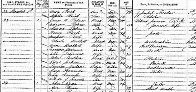
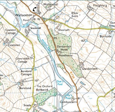
Eight years ago, I posted on the rootsweb message board regarding my BROWN ancestors farm, Woodhead of Dardarroch, in the parish of Glencairn. Recently someone replied that their ancestor was boarding with some BROWNS at Woodhead Cottage on the 1891 census. By 1891, James BROWN had died and his widow, Sarah (nee DOUGLAS) had moved away.  However, it is too much of a coincidence that the BROWNs still living at Woodhead were an entirely separate family as my BROWN’s had lived there since at least 1824 (discussed in this post).

I had long ago noticed the many BROWN families at and around Woodhead.  Now it was time to find out exactly how these BROWNs were connected.
Dardarroch via Get-a-map
First, I located William Brown at Woodhead Cottage on the 1891 census.  As you can see in the photograph above, Woodhead is quite a large house.  I presume Woodhead Cottage is the smaller part attached to the main building where the other family units lived together.  By this time, James’ widow and youngest son had moved to Keir where they lived in another home named ‘Woodhead Cottage’.
Woodhead on the 1891 census
I searched back for William BROWN (b.1829) and found him at Woodhead Cottage in all but 2 censuses.

Edited: It is here where I made a dangerous mistake.

! I found a William BROWN living at Shillanland (or Shillingland) with his uncle James FERGUSSON and a Jane and Sarah FERGUSSON.  I suspected one of these women (both listed as James’ sisters) was William’s mother.  Also listed was John BROWN (b. 1831) – I had discovered a brother to help with my search.

In 1841 the FERGUSSONs and BROWNs were all living at Burnhouse where the head of the household was a William FERGUSON and possible wife Mary.  This time Sarah was recorded as Sarah BROWN so is apparently William’s mother.  Since the 1841 census doesn’t record the relationships to the head, I will need to find records to prove William FERGUSON is his grandfather.  I will also search for a marriage between Sarah FERGUSSON and a BROWN. !

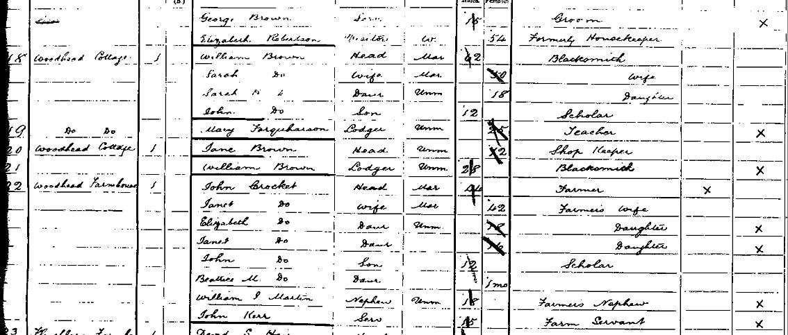
I now realise that this William BROWN is not the one at Woodhead from the 1861 census through to the 1901 census. A simple traceback through the censuses show that the head of Woodhead Cottage in 1891 is the son of George BROWN and Catherine McDOWAL – living at Woodhead from.  I now need only prove that George BROWN is the brother of my James BROWN


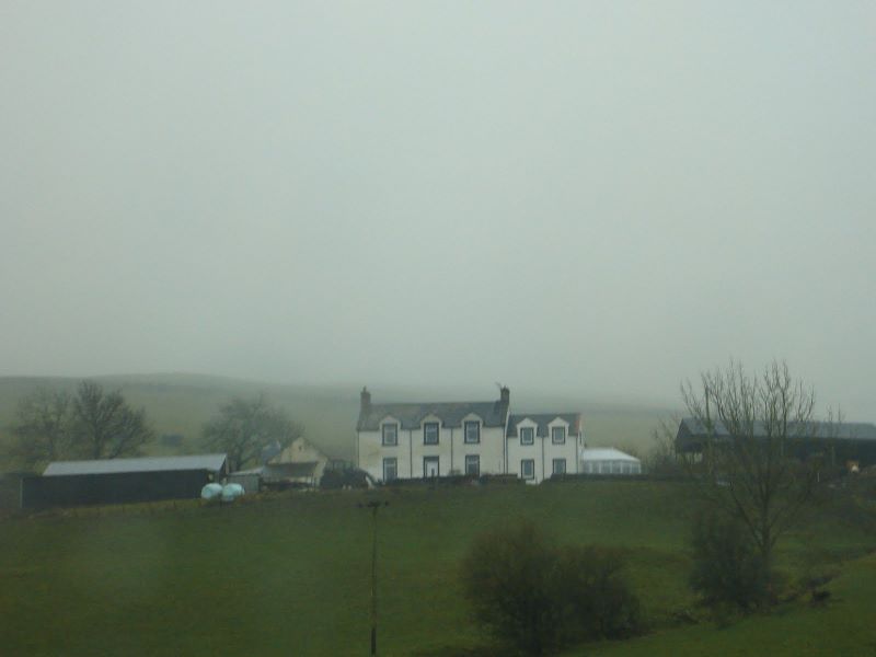
Edit 2: The picture at the top of this post is NOT Woodhead of Dardarroch as I mistakenly believed, it is actually a house called Woodhead in the nearby village of Dunscore. 

Next steps:

  • Find marriage record of Sarah FERGUSSON and BROWN
  • Find birth record of William or John BROWN
See following post – Neighbouring Families – Part 2

Future House Call (Using Google Street View)

Read 1st part here.

After his second wife died, George seemed to move around, lodging at various places in London. His marriage to second wife Emily FELLA was so short that it didn’t feature in any of the censuses (they married in 1873 – she died in 1875). Luckily for me, Emily’s death certificate lists George as the informant and his residence as 54 Swinton St, London (Emily also died here).

Death Certifcate of Emily Jane FELLA -1875

A quick search of Rumsey’s site informs me that houses still exist at this site:

I am aware that house numbers changed at some time in the past and need to check that number 54 Swinton St today is the same number 54 Swinton Street of 1875. Even so, it’s another address for me to visit when I’m in London. I like being able to get a feel of how my ancestor’s lives may have lived.

I used Google’s street view for a quick peek at the area. (Click and drag the orange man on to the map and use the on screen tools to have a look around.)

Did the PALMERs live (and in Emily’s case, die) in these buildings:

Or these?


Read 3rd part here.

House Call

Whilst reading my copy of ‘Your Family Tree’ magazine, I came across a great resource for people with London ancestors. The David Rumsey Historical Map Collection includes an 1843 London map which you can transpose over google’s current satellite map. This would have saved me a lot of time a couple of years ago.

I don’t have many links to London in my tree. The only significant person in my tree to reside in London was George Wright PALMER and part of his family.

George was born in Portsea and his job in the Royal Navy caused him to move around a bit. For some reason, George was in London at the time of the 1871 census. He was living at 33 Marshall St with his first wife, Mary Ann and youngest son, Edward.

Palmer family in 1871 census
When I went on the hunt for this address a couple of years ago, I had to switch between windows and use educated guesses to pinpoint the locations. With Rumsey’s site, I was able to search and quickly locate Marshall St in Westminster.
Marshall Street, Westminster

Here is a photograph I took of what I believe to be 33 Marshall St (I found it the hard way but using this map overlay it was so quick and simple):

33-36 Marshall Street c2000s (no.33 in foreground)

Here is a picture I found of 33 – 36 Marshall St, taken in the 1960s (annoyingly from the opposite direction to my picture):

33-36 Marshall Street c1960s

It’s hard to say how long George and his reduced family lived at this address. Mary Ann died the next year and he married his second wife, Emily Jane FELLA in 1873. Tragically, she died just two years later.

I’m not often able to find detailed information on the houses in which my ancestors lived, which makes the details I found at British History Online even more special:

Most of these buildings […] were erected in the 1820’s by or under the supervision of Thomas Finden after the closure of Carnaby Market […]. This redevelopment was uniformly planned, small in area and scale, but forming to-day an unusually pleasant oasis for pedestrians, and offering facilities for shopping away from the through streets. There is accommodation for shop-keepers over the shops, as well as for chamber trades such as tailoring. The least altered parts are the block bounded on the west by Newburgh Street and on the south by Ganton Street, and the two pedestrian courts west of Newburgh Street—Lowndes Court and Marlborough Court.
The prevailing form was the four-storey terrace house fronted in stock brick, two windows wide with plain window-openings, and a continuous plain parapet with stone coping. The windows, most of which have their original narrow glazing-bars, have stone sills. The ground floors were built as shops from the beginning, for this was the period of the planned shopping street…
The ground floors of Nos. 33–36 Marshall Street have thin pilaster-strips and a continuous entablature; space appears to have been provided for shop-windows but, except at No. 35, these spaces have only one domestic-size window each. The ground floors of Nos. 20–22 Peter Street are similar.

(From: ‘Marshall Street Area’, Survey of London: volumes 31 and 32: St James Westminster, Part 2 (1963), pp. 196-208. via British-History.ac.uk (Date accessed: 10 Jan 2010). 

[Bold font added for ease of reference]

Read 2nd part here.