
‘Lower Shobrooke’ was a property owned by members of the Wreford family. Often described as being situated in Morchard Bishop, it is closer to the Hamlet of Morchard Road (within the parish of Down St Mary). It is described as a ‘detached period farmhouse‘ or a ‘period cottage’ but the exact period this refers to is unspecified.

It is unclear when the property entered Wreford hands but the estate was mentioned in the Domesday Book as ‘Schipebroc’ (Sheepbrook), and apparently even earlier in a charter of 930 AD.
The estate passed from Matthew Wreford (1712-1752) to his eldest son Matthew (1741-1821) and (it seems) subsequently to his son John (1765-1845).
Matthew (junior) had to wait until he turned 24 before inheriting – he was only 11 when his father died. (Matthew senior died at the age 40, and eleven years before his own father Matthew Wreford ‘of Middlecott’ (1682-1763).
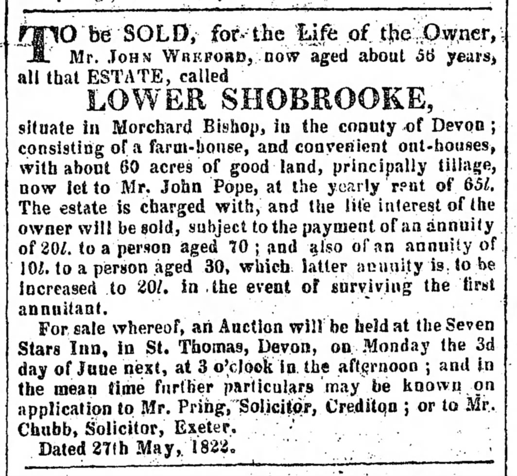
In 1822, Lower Shobrooke was put up for auction “to be SOLD for the Life of the Owner, Mr. JOHN WREFORD, now aged about 56 years…”
However, it is unclear whether the property sold as his wife, Betty (nee Hosegood), was described as ‘of Lower Shobrooke’ when she was buried in 1829.
In the 1841 census, three families were living at ‘Shobrook’, including the family of John Wreford (1817-1892). (He was the great grandson of Matthew Sr’s brother William Wreford (1717-1763). This John Wreford was recorded at ‘Higher Shobrooke’ in the 1851 census.

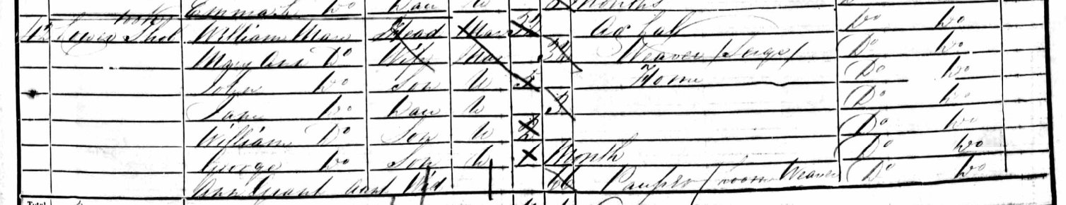
In the 1851 census, two families were recorded at ‘Lower Shobrooke’, named Mann and Warren. The heads were recorded as agricultural labourers so would not have owned the property.

My ancestry
Matthew Wreford (1712-1752) was my 7th great-grandfather.
Links related to Lower Shobrooke:
Shobrooke Farmstead on Heritage Gateway (Devon & Dartmoore HER)
Real estate catalogue
Lower Shobrooke, Wreford Name Study wikitree category – lists profiles of Wrefords connected with the property